Next Council Meeting
Information on upcoming Council meetings, Committee meetings and Public Hearings.
Learn More
 The Official Web Site of the State of South Carolina
Lexington County administrative offices are open Monday through Friday 8 AM to 5 PM
The Planning & GIS Department is involved in many ongoing projects. Here is a summary of each.
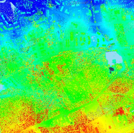
LiDAR (Light Detection And Ranging) was flown in January 2010 as a joint project with the Federal Emergency Management Agency (FEMA), U.S. Geological Survey (USGS), South Carolina Department of Natural Resources (SCDNR), and Lexington County. Because this project was funded by federal and state agencies as well as Lexington County the LiDAR data is in the public domain. Data from this project can be accessed on the SCDNR website, by clicking the link for "LiDAR Status" on the right side of the page. A data sample from this project has already been used to assist in the 12,000-Year History Park study by the River Alliance.
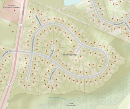 The Planning and GIS Department has created a geographical database of addresses in Lexington County. This database increases the accuracy and efficiency of routing for E911 calls in Lexington County. Public Safety, Emergency Management, and many others also benefit from this database.